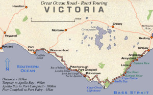
This morning we enjoyed breakfast with the b&b owners, said thank you and farewell, then headed off for our third day on the Great Ocean Road.
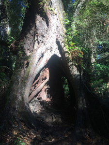
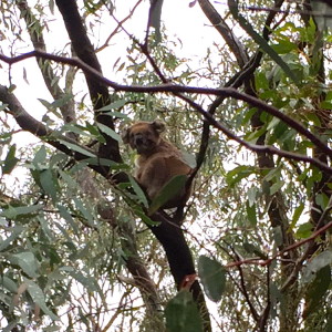
On our first adventure was heading into a forest in our van, and soon after getting stuck in a ditch of mud! With the severe drought, the ground was not ready to handle this amount of rain, and our car was not able to handle the slippery ground trying to go uphill. Our tour guide called the b&b and shortly the husband came to save us with his tractor. It wasn’t the most ideal start to the day, but worse things could happen!
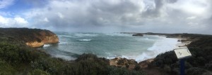
Port Campbell
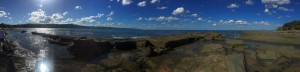
This was the most WINDY place I have ever been to in my life! It was a beautiful lookout, but maybe more so when you can actually see it without wind-induced vision impairment. Port Campbell does have a very small boat pier, and is a very small town. With a population under 100, it’s main purpose is catering to the 12 Apostles tourism industry.
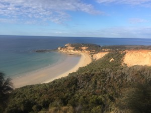
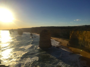
London Bridge
This was also one of my favorite stops of the trip, a gorgeous lookout that was also very windy. At the most northern point in Mornington Peninsula National Park, and bordering Point Nepean National Park, the structure is composed of sandstone. Although originally a double-span natural bridge, the structure weakened through weathering action, and in 1990 the first archway collapsed. Two tourists were stranded on the outer span, but no one was hurt and they were brought inland by helicopter. Originally called the London Bridge, it is now referred to as the London Arch, respective to the change in its structure.
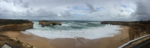
London Bridge
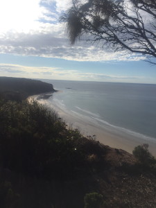
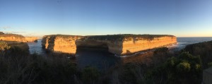
Bay of Islands
Our last coastal stop of the trip was the Bay of Islands, where a short cliff walk leads down stairs to the beach. Here we spent a few minutes on the breathtaking beach, looking up at the sheer cliff faces and seeing the rock columns in the sea from ground level. It was an incredible view!
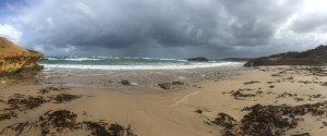
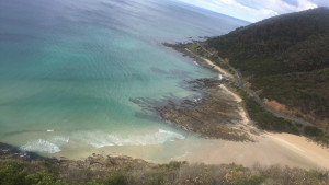
Bay of Islands beach
Bay of Islands lookout
Red Rock
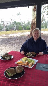
After enjoying a light lunch at the Timboon Railway Shed Distillery (in the town of Timboon), we drove inland to Red Rock. This volcanic complex is part of the Otway National Park, where volcanic eruptions created craters. A few of these craters filled with water to create lakes, including Purdiguluc, Werowrap, and Coragulac. There are over 40 centers with various sizes, and we visited the top of the Coragulac Lookout. We could see for miles around the impressive landscape, and although it was still very cold and windy, it was a great way to wrap up the tour.
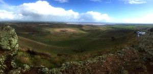
Craters of Red Rock
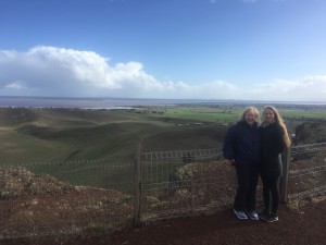
Coragulac Lookout
Overall, I would HIGHLY recommend this tour (Echidna Walkabout – 3 Day Great Ocean Road). It was expensive, but considering two nights of great accommodation, all food, and three days of tours are included, it turned out to be rather reasonable. It was a fantastic experience, and probably one of my favorite adventures in Australia so far!