Tag Archives: hiking

You probably don’t have time to do Mt. Doom.

So this past weekend, a few of us die hards also known as Sarah, Jenna, Meg and I, decided to make another attempt at the Tongariro Crossing. We waited until the very last minute before going, just in case the weather wanted to hate on us again, but the forecast called for fine weather with light winds. Win! Jenna and I picked up our car in town on Friday and drove to Student village to get everyone. Obviously, I immediately had to parallel park with 5 or so uni students pointing and laughing.


bad park.jpgOnce we were on the road though, it was easy enough to forget we were driving on the wrong side and everyone thoroughly enjoyed the freedom of being able to stop whenever we wanted and not have to spend 30 minutes in the Rotorua visitor centre. Again.


bad park 2.jpg

We stayed at the Crossing Backpackers again and felt like we hadn’t even spent a week away. Friday night was spent playing pool (pretty terribly on my part) and getting ready for our 7:45am bus to the crossing the next day. The next morning dawned with clear (ish) skies and we got on our bus so excited to finally be able to do the hike.


finally!.jpgMeg assigned everyone Lord of the Rings characters since we were in the land of Mordor. She was Frodo, I was Sam, Jenna was Gandalf, to some confusion since she hadn’t seen Lord of the Rings, and Sarah was Gimli, because she was wearing her red hair in a braid, haha. The only problem was we didn’t get to the beginning of the 20km or 10 mile track until 8:40am and our bus on the other side left at 4:30pm. The estimated time to complete the crossing was 7 to 8 hours and that didn’t include climbing Mt. Ngauruhoe or Mt. Doom (!), an extra 3 hour side trip. We had roughly 8 hours and there was no way we were skipping Ngauruhoe. The Fellowship needed to make it to the top of Mt. Doom. We made pretty good time to the base of Ngauruhoe, including climbing Devil’s stairs. Meg and Sarah flew up them while Jenna and I took our time a little bit.


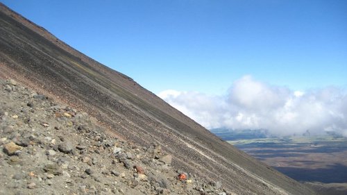
Bottom of Mt doom.jpgClimbing Ngauruhoe is almost impossible to describe. There’s no real track and the best way to do it is to, well, scramble. Imagine trying to climb a massive sand dune,  that also happens to be an active volcano. There was so much volcano ash and lava flow that every step you took, you would sink back down the 45 degree slope a few steps. slope.jpgAlso, the rocks aren’t anchored to the slope so every ten minutes of so, someone above you would whistle and start yelling “Rock! Rock!” and you’d see some boulder hurtling down towards you. One man was unlucky enough to get hit by one of these falling rocks and had to be taken off the mountain by helicopter since it smashed his leg. Finally, after a gruelling hour and a half of climbing, we made it to the crater. Everything was tinted red and looked like Mars but the cloud would clear every so often and you could see for miles over rolling hills and forests, reminding you that you hadn’t actually left the planet. Obviously, we needed to celebrate and had joked the week before about cracking a bottle of champagne at the crater. No one actually drank it, but who else can say they’ve sprayed champagne into the crater of a volcano??
 

popping bottles.jpgPopping bottle ^

crater red.jpg

Jumping pic red crater.jpgWe didn’t think jumping by the crater was a good idea at first, but we got a great pic ^

The way down Ngauruhoe was, for me, almost as difficult as the way up. It was so steep with so many loose rocks and ash that every time I’d get into a rhythm, sort of like skiing, my feet would slip out from under me and I’d land on my back. I think Meg put it perfectly in her blog “slide, fall, eat shit, volcanic rocks up the butt.” I emptied so much ash out of my shoes, socks and pants at the bottom!

The rest of the crossing was beautiful. We climbed up to Red Crater and then down to the emerald lakes which are turquoise because of all the volcanic minerals. Lakes.jpgSome crazy hikers actually stripped down and swam in them which is a horrible idea because, a.) They’re sacred to the Maori, b.) They could easily be poisonous and c.) You’re on a windy mountain, with 11km more to hike and it’s FREEZING!
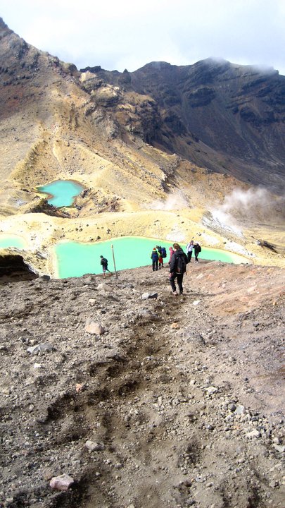
emerald lakes, me.jpgAfter the emerald lakes, we realized that we really needed to start booking it in order to make our bus. From the Ketetahi Hut, the sign said it was another 11/2 to 2 hours to the car park. We had an hour, whoops. Meg ran the rest of the way since she’s a champ but I decided on a power walk/occasional jog. My legs were ready to drop off at that point.

When we finally reached the car park, the bus said they weren’t going to leave without all their passengers and that we weren’t the last ones off the track, there was still about 7 people behind us.

Back at the backpackers we showered and were offered dinner by some really nice older people who turned out to also be from Hamilton and worked at the uni. Scalloped potatoes, lasagne, and mini quiches were really what we needed to end such an awesome and tiring day. Watching Return of the King followed dinner, which was a fitting ending to the trip although no one could really keep their eyes open to finish watching.

The next day, we said goodbye to the backpackers once again and headed to Waitomo Caves. Meg and Sarah went blackwater rafting, but Jenna and I opted not to and instead we limped (everything hurt) round the Kiwi sanctuary to see if we could finally see the mythical kiwi. They were SO CUTE, even if there were only two of them. We also found some ostriches on the side of the road which were a tiny bit scary…


ostrich.jpgBack to Hamilton and now I just have to write two papers before more adventures can begin.

Karen


Location: Tongariro National Park, New Zealand

Too meke!

Firstly, “too meke” is Maori for “too much” and seems to have become a slang way of saying, “wow, I’m laughing so hard my ribs hurt”.

These past two weeks have been fantastic despite some bad weather. Last weekend Morgan, Jenna and I, took a trip with Uni to a local farm. The farm was only about 15 minutes outside of town and the weather was beautiful. They fed us a delicious lunch of pies, sausage rolls and desserts before walking us up to the top of one of the hills. The farm was huge and we had great views of Mt Karioi and the Waikato River from the top. Our guide and host, Neville, told us that, technically, you could see both the Tasman Sea and the Pacific Ocean. Later, we watched the sheepdogs muster the sheep so they could be sheared and everyone watched while the sheep went from being fluffy and cute to bald and slightly scary looking. It was a really fun day trip, everyone learned a lot about farm life and petting some sheep is really just a necessary thing to do if you live in New Zealand.


farm.jpgThomas, Morgan, Jenna and I at the farm ^


This weekend we had planned to hike the Tongariro Crossing down in Tongariro National Park, a 7 hour hike over the volcanoes and to the summit of Mt. Nagarahoe, also known as Mt. Doom from The Lord of The Rings.


mt doom.jpgNagarahoe ^ 


Maori legend has it that when Ngatoroirangi, the high priest and navigator of Te Anawa, one of the first Eastern Polynesian canoes to land in New Zealand, climbed Tongariro, a strong south wind blew and he almost froze. He called on his sisters from the Maori homeland for help and they arrived in the form of fire, leaving geysers and volcanic activity as they travelled across the North Island to Tongariro to warm the priest. The name Tongariro means “south wind” and “seize” representing the near death of Ngatoroirangi.

Clearly this legend has some merit, because as we arrived in the National Park, the skies were grey, the jackets were out and the forecast was predicting gale force winds. Luckily our hostel, a backpackers in the middle of the park, was awesome. We were picked up from the gas station where our bus dropped us by an Aussie called Alex and driven into the wilderness. We unpacked went exploring, saying hello to Daisy the pig and the adorable foals in the paddock.


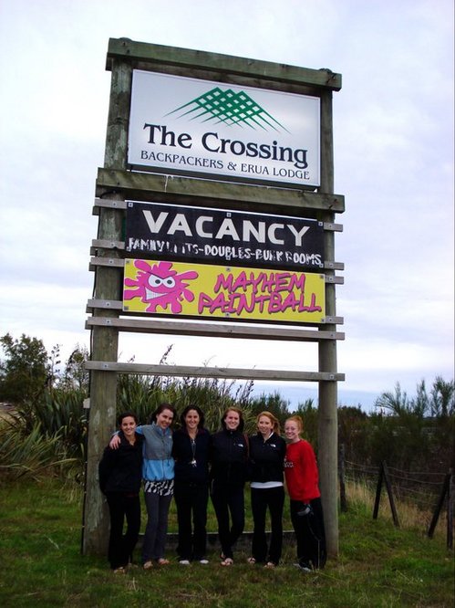
crossing.jpgThe gang under The Crossing sign ^

After deciding the weather was too horrible for exploring, we opened a case of Speight’s beer as we settled in for the night. The hostel had a games room which had a secret wardrobe to Narnia which added to its appeal and a brand new glow in the dark paintball shed out the back so later on in the evening, everyone trekked over there with the hostel’s owner Bryan for some fun. It was my first time playing paintball and at first I was pretty terrified. We had a few practice rounds, shooting the piles of tyres and the noise it made echoed through the barn. All in all, I don’t think I did too badly, although I wasn’t really keen on sacrificing myself to get the flag. Some of the welts on people’s arms and legs after the game were enormous and I’m glad I got away with relatively few!


Paintball.jpgPAINTBALL!!!! ^

That night we went to bed praying for the weather to clear up since the crossing would be cancelled if it didn’t. No one slept much and when 6:30am dawned with howling winds and torrential downpour, we knew the crossing wasn’t going ahead. Instead we headed up to Mt. Ruapehu and took a three hour hike from the Whakapapa (pronounced with an F instead of a Wh. Easy compared to “Taumatawhakatangihangakoauauotamateapokaiwhenuakit anatahu” which is actually a place!!!!) ski field to Taranaki Falls. The walk was great even though it was pouring and you couldn’t see the mountains through the mist.


waterfall.jpgAlex came and picked us up around 3pm and we headed to the pub for a pint as we watched New Zealand cream South Korea in Rugby. That evening, everyone gathered round the table and a good time was had by all as a bottle of red wine became champagne, Carlsberg and Jim Beam. There were another couple of kiwi guys hanging out with us and kept repeating “too meke” when they were laughing, which is the first time I’ve actually heard it in conversation.


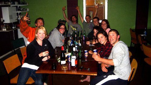
fun!.jpgGroup shot ^

The hostel was the friendliest I’ve ever been to and sitting round the table with Bryan, Alex and another guy who worked there, Luke, we felt like extended family, even helping out with some mural painting and replacing the toilet paper in the bathrooms at 2am! At 4am, we decided to call it quits as there was still a vague hope the weather would clear up and the crossing would be available in the morning.

No such luck, but we’re already making plans to go back next weekend for a second attempt. The volcanoes are beautiful in good weather and are something that we really don’t want to miss out on!


what if.jpgWhat we would have seen, had the weather been nice ^

Karen


Location: Hamilton, New Zealand

Yunnan: Part One

Yunnan Part 1:

As part of our learning experience, IES arranged for us to go on a 2 week trip to Yunnan Province, including many a cool cities and villages.  It was a four hour flight from Beijing to Kunming.  When we arrived, I was amazed!  Compared to the frigid sub-zero capital, Kunming seemed like paradise.  My teacher described it as the San Francisco of China: palm trees, mountains in the distance, 70 degrees in the winter and 80 degrees in the summer.  Yeah, pretty nice. 

We stayed there for a few nights before heading out to a different city called Dali.  Dali is known for its historic significance as well as its old city, which features old school Chinese architecture and quaint stores and shops.  There we did a bicycle trip and even went to a hot spring.  The hot spring actually surprised me a bit.  Apparently, most hot springs are sulfur hot springs.  That means that the hot water is accompanied by a foul-ish-but-you’ll-get-used-to-it-egg/fart smell.  This was especially apparent when I took a poo and washed my hands with warm water.  I thought to myself “dang, it couldn’t have been THAT bad”.  Also, in Kunming and basically all of Yunnan, the bathrooms are characterized by squatter style toilets, no toilet papers supplied, no soap in the sink, and no towels/dryer.  As a person with limited leg flexibility, it took a good getting used to and training from my more balance sensitive friends before I could effectively cop a squat.  Also, bring your own toilet paper and sand sanitizers.  Although some of the nicer hotels will have completely western style bathrooms. 

We had a buttload of hiking trips.  I think we had 4 hiking days in total, which is complete nonsense if you ask me.  Beautiful, awe-inspiring, and majestic.  But complete nonsense.  The first one was by a smallish mountain in Dali.  It was well paved, the incline was gentle, and the altitude wasn’t too high.  Completely doable, I thought.  But the fact that there was no fence freaked me out something fierce.  I walked almost exclusively on the right, where the comfort of a mountainous wall was present.  The second/third hiking trip was on Tiger Leaping Gorge.  If you don’t know anything about Tiger Leaping Gorge, it’s the second largest gorge in the world, the first being the Grand Canyon.  Compared to the small mountain in Dali, which was fully equipped with a chairlift to take us halfway up and a gondola to take us the full way down, TLG was hell wrapped in tortured filled with contemplative suicide.  No fences, rocky slopey terrain, bridges made from 4 pieces of timber lying next to each other, waterfalls.  It was the real deal.  It was the mother of all hikes.  I came, I saw, I conquered.  Then I died. 

I went to bathroom on the most gorgeous bathroom in the world.  It was at a guest house/hostel deep within the mountain summit.  The bathroom is made up of 3 walls, two of them are on the side and one of them is the door.  The last side is an open air expansion facing the heart of TGL.  I took a pee while beholding the most beautiful sight I have ever beheld.  It was kind of cool.  Oh yeah, and I tagged this as a “global citizenship” thing because… well, I guess the travels made me more cosmopolitan and thus a citizen of the global variety.  Mehh.

Next up, pics and Yunnan: Part 2


Location: Kunming, China

Survey Says…

This past week has been a lot of work and non-stop adventure.  It began on Tuesday when we went to Magombero Forest with a professor from the Sokoine University of Agriculture.  We went traipsing through sugar cane fields and a then through a very dense forest to see examples of deforestation.  I didn’t have much time to observe the deforestation because I was too busy dodging stinging nettles and sprinting through nests of biting fire ants.  Those things are the most malicious bugs that I’ve ever encountered!  They actually borrow through your clothes to get to your skin.  It’s like they’re out for revenge for disturbing them.  One of the guys on the trip got them all through his clothes and actually had to strip down in the middle of the forest to get them off of his skin!  Welcome to the jungle.

Wednesday was spent working on my paper about how rural land use planning can aid biodiversity conservation…whew!…a definite challenge for a marketing major.  Can’t say I’m not earning my science credits. 

Thursday and Friday were spent surveying the village of Tundu.  We took a tiny rickety bus called a Dola Dola 75 minutes each way over the rockiest dirt road I’ve ever seen.  Oh, and the horn sounded just like a carnival ride theme song – not at all like the standard “Beep! Beep!” that we’re used to.  The bus driver seemed to really enjoy the sound of the horn as he laid on it for minutes at a time (as though a bus full of white kids didn’t attract enough attention on its own)!  At long last, we arrived at Tundu and got right to work surveying the town to help them create a map.  Only a basic outline of the area exists, which makes planning for roads and other structures nearly impossible.  We spent the entire day measure people’s homes and yards.  It was a really cool way to see the culture.  Tanzanians are so proud of their homes.  One man took me by the hand and led me to a wooden crate in his back yard.  He opened the lid and out jumped four or five rabbits!  He really enjoyed my shock (an expression that translates in Swahili).  Some of my favorite highlights from surveying were the witch doctor’s house, the school of children swarming us, and a mansion belonging to a woman who is a top five sugar cane grower in Tanzania.  Rumor has it she kicked her husband to the curb because she was already rich and didn’t find any need for a man.  In Tanzanian society, especially in rural areas, that almost NEVER happens.  Women are very submissive and do intense manual labor for their husbands, so I got a big kick out of this female power house.  We made a ton of friends simply by giving high fives when they would yell out “Obama!”  It’s a good time to be an American in East Africa!

Today we saw a ton of performances from the elementary school kids for a national holiday known as World Environment Day.  They performed traditional African dancing, drumming, singing, and even skits.  It was a ton of fun to support them and all of the work they’ve put into this conservation education.  They took to us as well.  By the end of the day, I think 500 kids had pet my hair, help my hand, or danced with me.  I couldn’t walk anywhere without a giant mob surrounding me – a very strange feeling.  Tomorrow I leave for an African safari in Mikumi!  It should be absolutely amazing.  I met a tourist today who came straight from Mikumi and described it as the Garden of Eden.  I’ll fill you in when I’m back!


Location: Mang'ula, Tanzania

Walking, hiking and running through Tanzania

Time for my official 4th blog entry….or 5th if you count the double entry my stupid internet made. It is currently 3:20 pm here in Tanzania. I have officially settled into our home here at the Udzungwa Ecological Monitoring Center and we are about to start our real work! So far we have been preparing to create plans and such by learning about the culture, conflicts and key issues. As we continue to do that, we need to start thinking of a final project for the summer. On Thursday and Friday we will be heading out to Tundu to survey and map the community. Apparently they are facing a quick increase in population due to their proximity to the sugar cane fields and they need a plan on how they should grow. Currently there are no maps or anything for the village so our work to create a map will be extremely helpful for planners or for the landscape students here who want to design a plan. Surveying is tedious work. We have to write down every single GPS coordinate that is relevant (corners of buildings, road ways, foot paths, etc), sketch the area along the way and record everything with pictures.

Since I last wrote we had some interesting times. One day we went throughout the area to see different places where villages have encroached on the national park land. Just a warning – if a Tanzanian ever asks you to go on a ‘walk’ put on your hiking boots. Our guide had our entire groups scaling the hills, walking through the forest and down steep hills. Of course he was running around with ease but the rest of us were not expecting the challenge and fell way behind. Seeing the park encroachment was interesting though. There were points where the land had been used up so much it was practically a wall of dirt right on the border of the park.

Then this last weekend, some of our group went on a hiking/camping trip up to Sanje falls. In my last entry I was excited about the 150ft waterfall. Sanje falls is 750m. I don’t know exactly how many feet that is but I know it is a lot more than 150! The hike itself was only hard for the second half. The first half was manageable until we got to the first view point. After that the path was pretty much straight up – I thought my legs were going to give out underneath me. We went swimming at the very bottom of the falls where a pool has formed and then again at the very top of the falls. The power of the falls at the top was surprising! The current was stronger than what you would feel in the ocean; the only thing that stopped us from going over the edge was the rocks lined up on along the border. At the very top, the view was spectacular. We could see the whole valley while hearing the falls around us. Once at the top we set up camp and spent the night. It was a hard night’s sleep but well worth it when we woke up early to watch the sunrise at the view. The coloring was beautiful. I have tons of pictures I wish I could post but you will have to wait and see. Google Sanje falls if you are interested in getting a preview.

Yesterday we took a field trip to see Mangombero forest. It is not too far from the national park but it is a completely unprotected piece of forest which sits right next to a village and faces a big chance of being destroyed. Anyways, this trip was hilarious. We had all 11 students, 2 professors and 3 guides walking along a tiny path in the woods. This forest had lots of army and fire ants mounds on this path. At a moment’s notice we would all have to start running to get away from them. Seeing all 16 of us bolt through the woods made me laugh every time. One poor guy in our group, Theo, had been standing on a mound for a few minutes – He had to strip down right in the middle of the forest to get all the ants off! I managed to not get bit due to a pants-tucked-into-socks maneuver but those little ants are tricky; even running I would still end up with some on my pants and shoes. Thank goodness for high boots, high socks and long pants! Overall it was an amusing trip…or at least I found it amusing since I never got attacked by the vicious ants.

Today is a work day for us before we head to the village tomorrow so not much will be going on. We do have a busy weekend coming up – International Environmental Day on Saturday and a 3 day-2 night safari at Mikumi National Park starting on Sunday


Location: Mang'ula, Tanzania