The first site we went to today was Kültepe. Kültepe, also called Neşa and Kanesh had occupation starting in the Chalcolithic and continued to the Roman Period. Kültepe at one point in its occupation was a  Hittite capital (this was the capital city that preceded Hattusha). Kültepe is the “Hill of Ashes,” as it has seen much destruction. The villagers were actually using soil from the site to fertilize their crops and were plowing the land in the lower city, which turned up cuneiform tablets. Over 100 tablets were found in the Lower City in the residential homes of individuals. These texts and other indicators denote trade with Assyria. Because of the location of the site, it would have been an important area for trade.
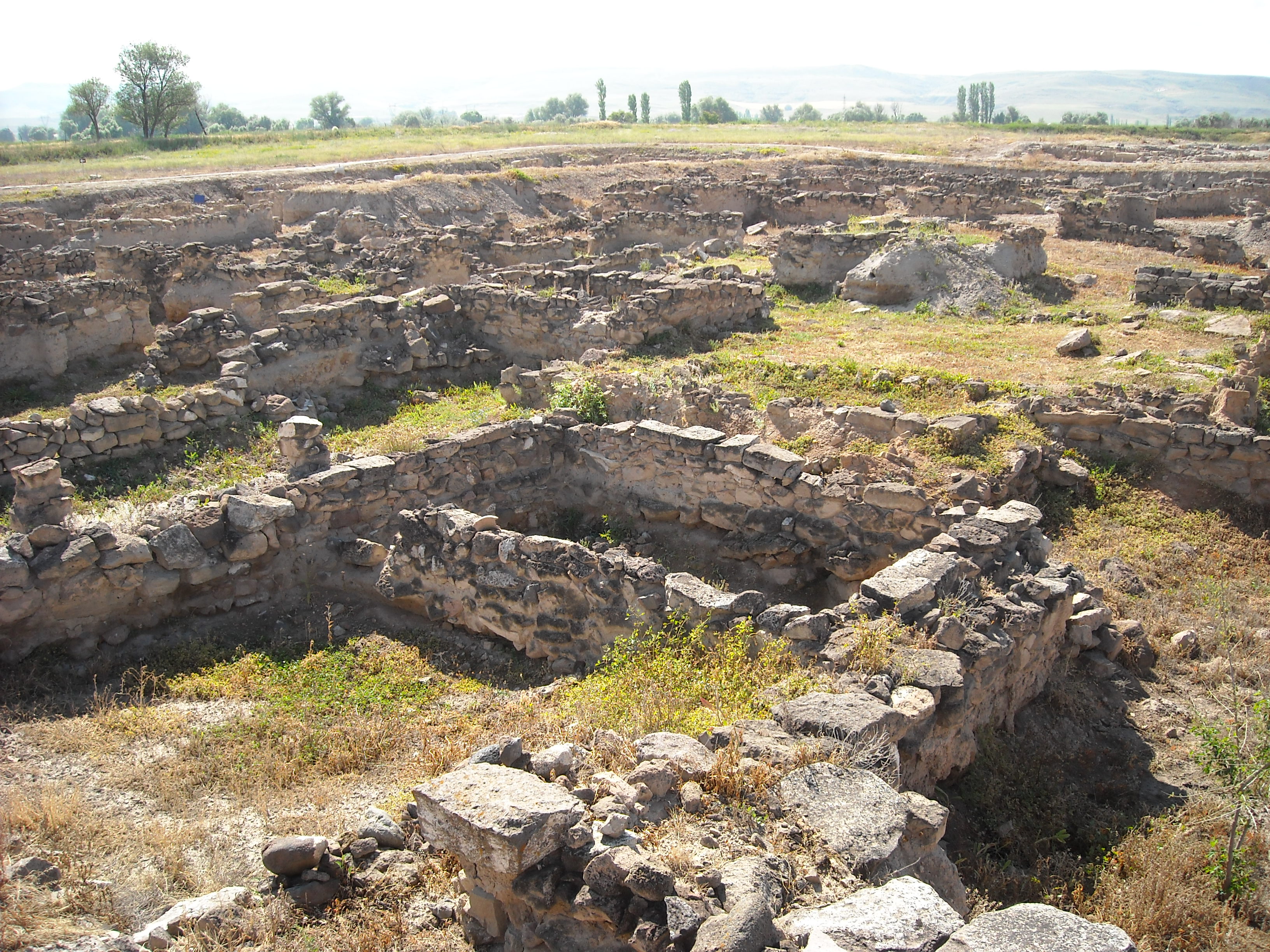 In the Upper City, no clay tablets were found, but the Warsamas’ Palace was found with fired mudbrick walls, which were vitrified. These walls gave a better idea of what kind of settlement was here, and how they were using natural resources to build their structures. Excavations were done on this site by Professor Tahsin Özgüç starting in 1948, and continuing until he died in 2005. It was interesting to see the site which preceded mine as the capital of the Hittite empire. I also found it interesting that both sites start out with Assyrian merchant occupation at the site. The lower city shows signs of the constant trade, and the site seems to have been in a very good location, otherwise people would have gone to another spot to live.
This was an interesting site to walk through. We did not have to have a guard with us, only our Tour Guide, and we were able to walk where we wanted on the site. This is not always a good thing, because those who do not care to preserve these places can have free roam, and may destroy more than they think simply by touching or putting pressure on an object in the wrong spot. I have to admit that even after seeing the sites up until this point, I am completely astonished at how anything from the past can preserve and give us a view of how things once were. These sites not only show what happened, but may allow us to stop a harmful event from happening simply by looking at reactions of the past and the outcomes that came from them. I know that it seems like archaeology is all about the past, but unless we put the information to use in the present day, there is really no point at looking at it.
After Kültepe, we went to a site called Kerkenes. When we got to Kerkenes, we were taking inside of the dig house by Scott Branting, the co-director of the site. He took us back to a room where he was able to show us maps of the site, and gave a brief overview of the site, and how the archaeologists working at the site were going about gathering and using the data. Kerkenes was an Iron Age capital with elements that suggest Phrygian origins. 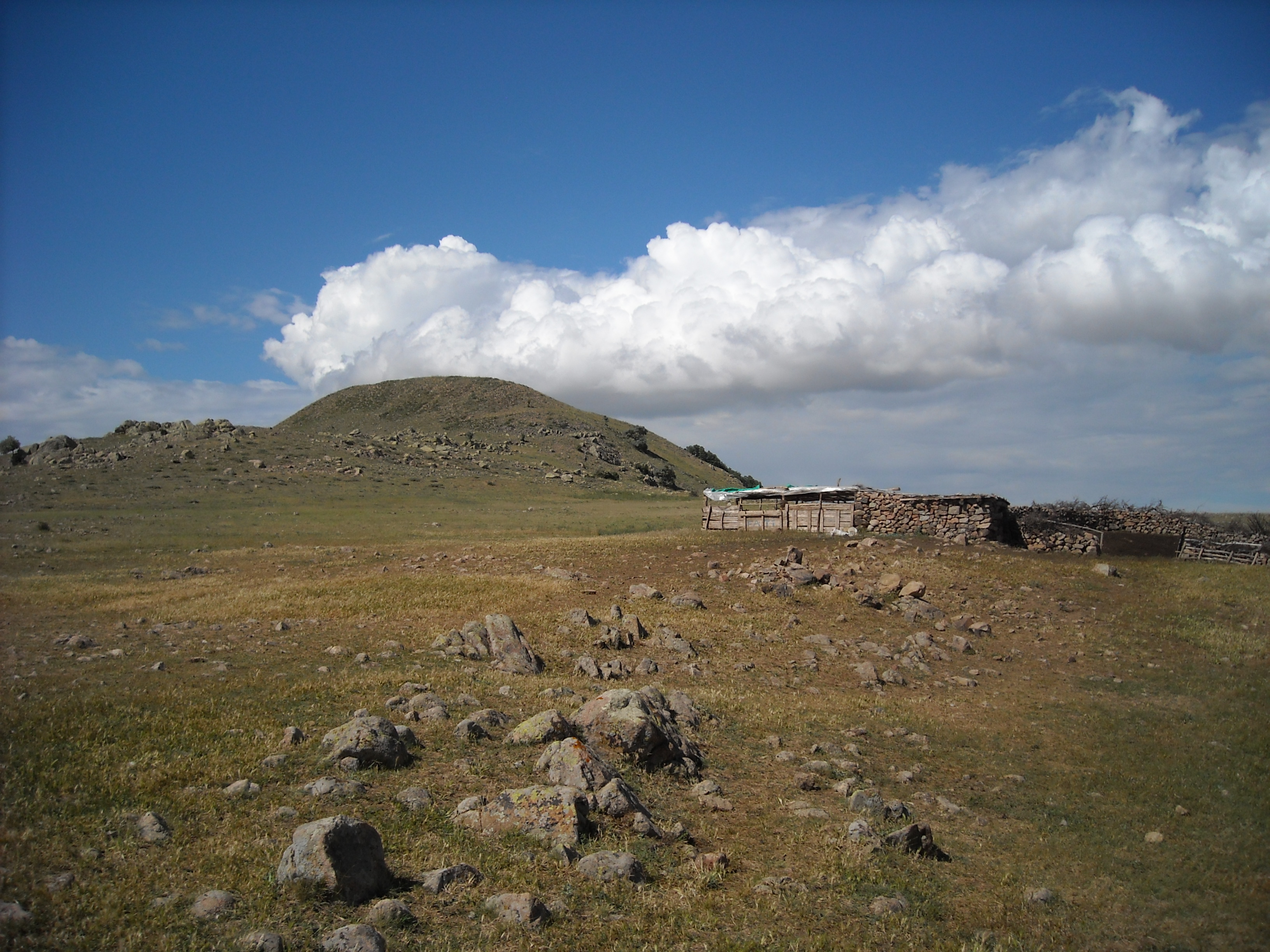 The Archaeologists excavating at Kerkenes think this site may be Pteria, which explains the short occupation of 40-60 years. After the only level of occupation is destroyed, no one built on top of it, leaving the perfect situation for archaeologist later to use Remote Sensing.
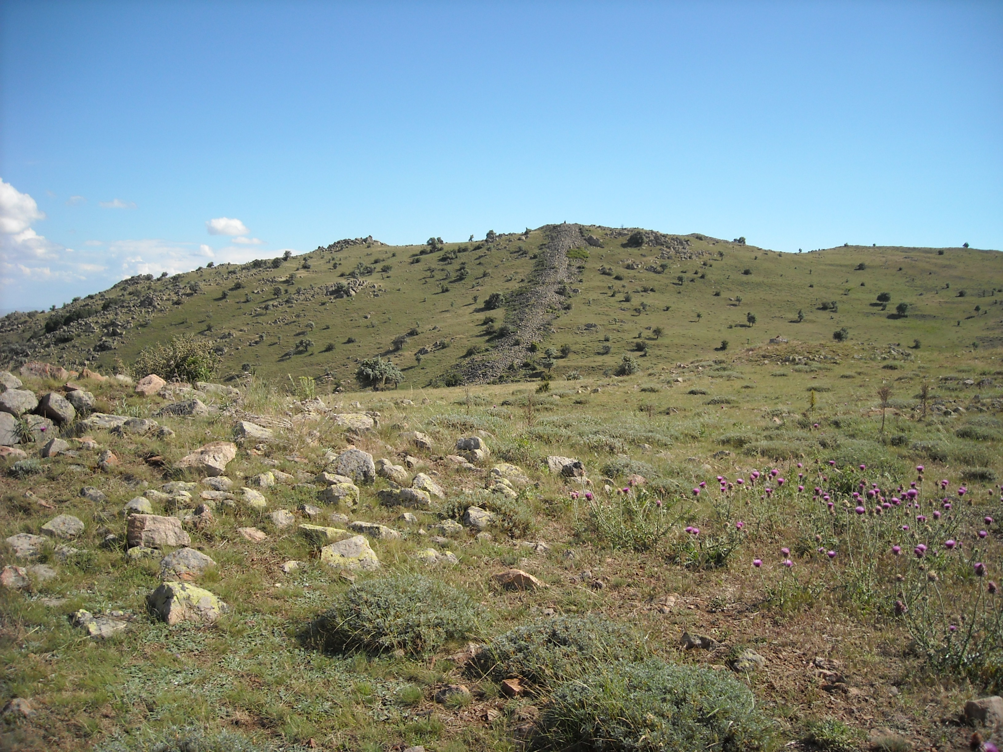
The archaeologists at Kerkenes are doing as much work as they can at the site without excavating. There is some excavation, but when they excavate a building, they leave half unexcavated so that people can go back later and check their work, or future archaeologists have better technology which they can apply to the site. 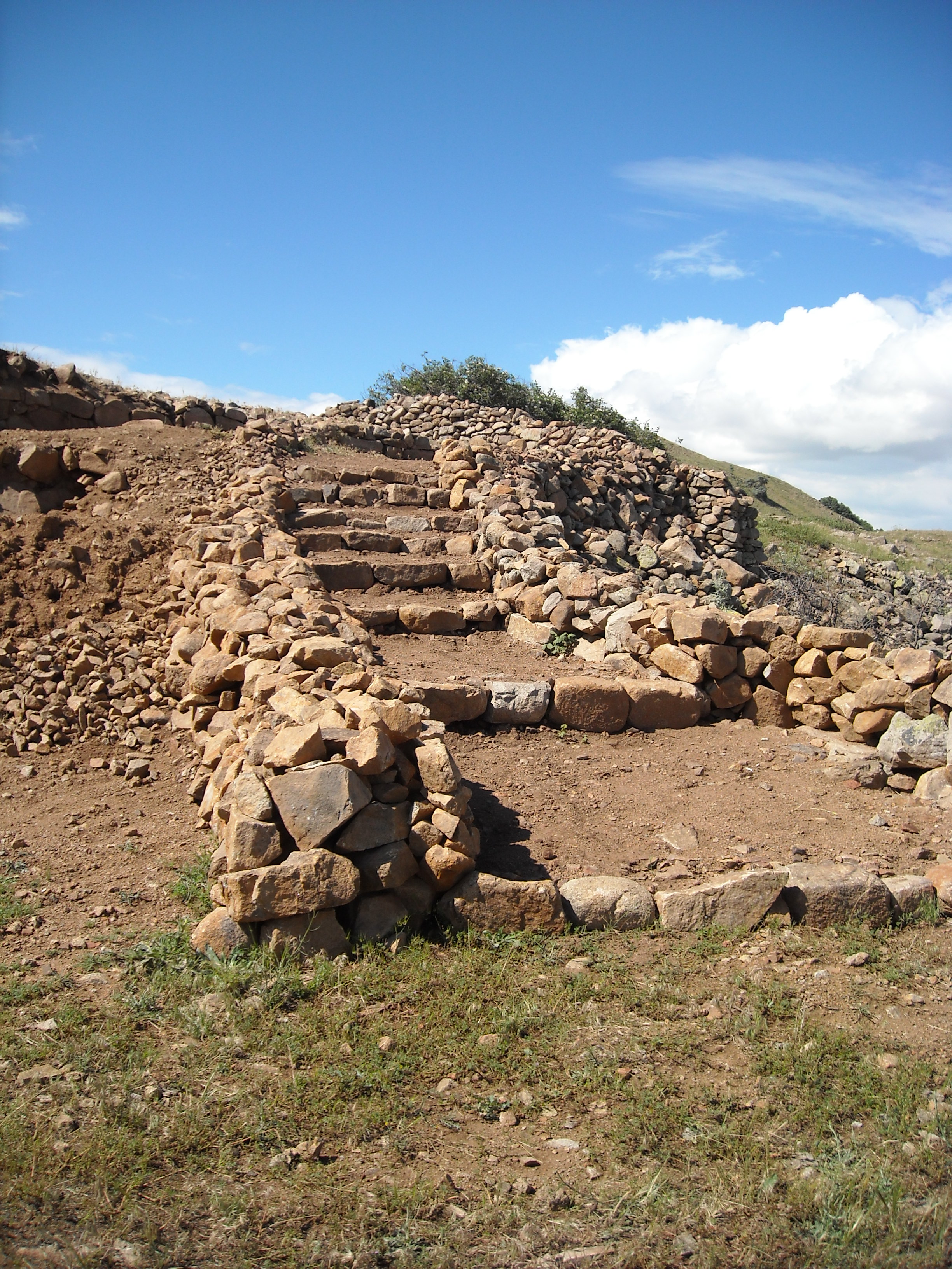 In place of excavation they have intensive GIS maps that include an extremely accurate TIN that has GPS points at every inch of the site (a total of 1.4 million points). After the brief introduction to the site, we took a bus up to the base of the hoyuk. We were given the option of riding in the back of the land rover up to the top of the site or walking up hill side. I choose the hill, which I have to admit did not seem as bad at the base of the hill as it did about two-thirds of the way up. The slope was much steeper than I had thought it would be. I feel like it would have been really hard to get all the points for the site. Especially since the slope I walked up was not the steepest at the site. Scott Branting informed us that many of the people who took the points ended up with twisted ankles.
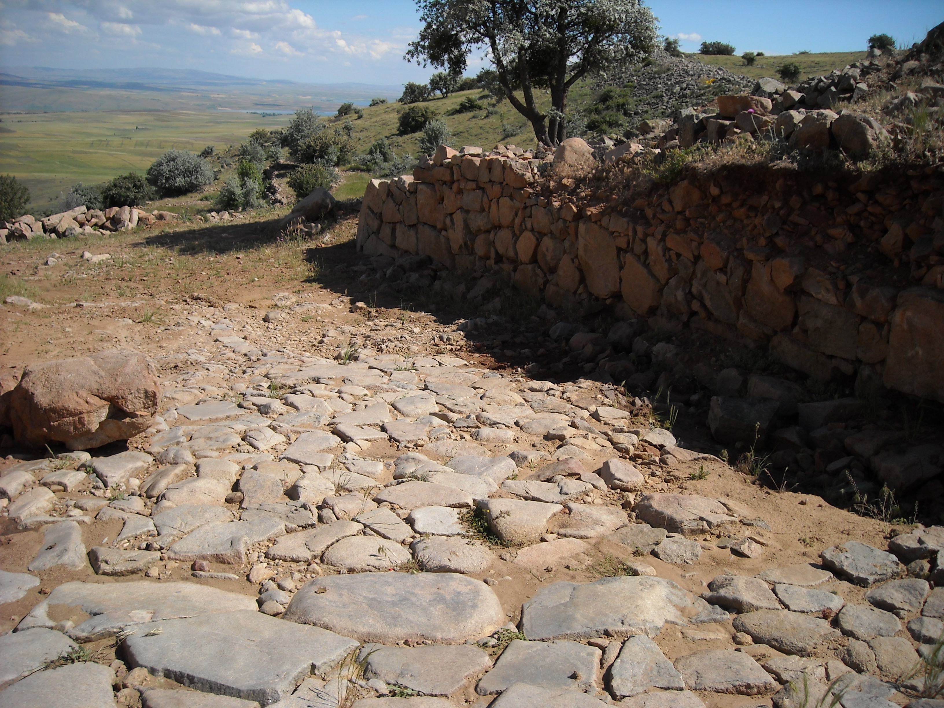 When we reached the top of the mound, Scott Branting gave us a tour of the site. After climbing down from the highest part of the mound, he took us to the Cappadocia gate. This is the largest of the gates, and what they think is the main gate of the site. Walking through, we were able to see the stone structure which was well put together, not leaving hand folds, or rough patches which would allow enemies to climb on. There were ponds which were used for the collection and storage of water in the site. As of now, they are full of leeches, which some people will travel to find because they are supposed to be good for the “health.” After passing both, we walked up to the remnants of the palace. We were able to see the throne chamber, but we did not walk far into the palace complex before we turned around and went back to the dig house.
 At Kerkenes, we also found out a little more on the status of research visas. Apparently most foreign excavators and surveyors had not received their visas. Without the visa, we are unable to do anything. Scott also told us that this year, and new law went into effect that dealt with excavations. If the Archaeologists are foreign, they have to pay an extra sum of money to start excavations for that year. The amount is about 20,000 dollars, and this can be troublesome for smaller sites that do not have as much funding. Also, few foreign archaeologists had heard back out their research visas. We at this point have not even been contacted about ours.
Location: Kilim Otel, Dumlupinar Cad. No: 50, Urgup-Nevsehir, Turkey