Tag Archives: archaeology

A Very Poblano Weekend

This past weekend was the one “free” weekend out of the trip where we wouldn’t be traveling as a group. That being said, we still manage to pack it with lots of exciting things here in/around Puebla! This was good, because I needed a lot of diversions to take my mind off of Friday’s mini ash-eruption of nearby volcano Popocatepetl. (It hasn’t had a major eruption in years, and I feel safe at this distance, but I have an irrational loathing/fear of volcanoes–how super.)


AfricamD2.jpgThankfully, one of the best and biggest zoos/safari parks in all of Mexico is only 25 minutes away from where we live in Puebla. We’re really starting to get a hang of the public bus system, which is really convenient–only 6 pesos one way! A bunch of us decided to go by bus to check Africam out, and it was one of the best decisions ever!

xIMG_3070.JPG 

Most of the park is set up like a safari that you drive through either in your own car or on safari tour buses, meaning that the animals have practically free reign of a large part of land. I really liked that, since I feel like seeing animals cooped up in cages can get a bit depressing.


After the safari, there was a whole other portion to the park, with more traditional zoo enclosures for the smaller kinds of animals. We got to do awesome things like feed Wallabies and fly high above the park, crossing bridges and cruising along ziplines in harnesses. It was amazing! (Major photo credits/thanks to Jess, Rihanna, and Dominique, by the way.)


xIMG_3261.JPGAfricam2.jpgAfricamD4.jpgxIMG_3302.JPG
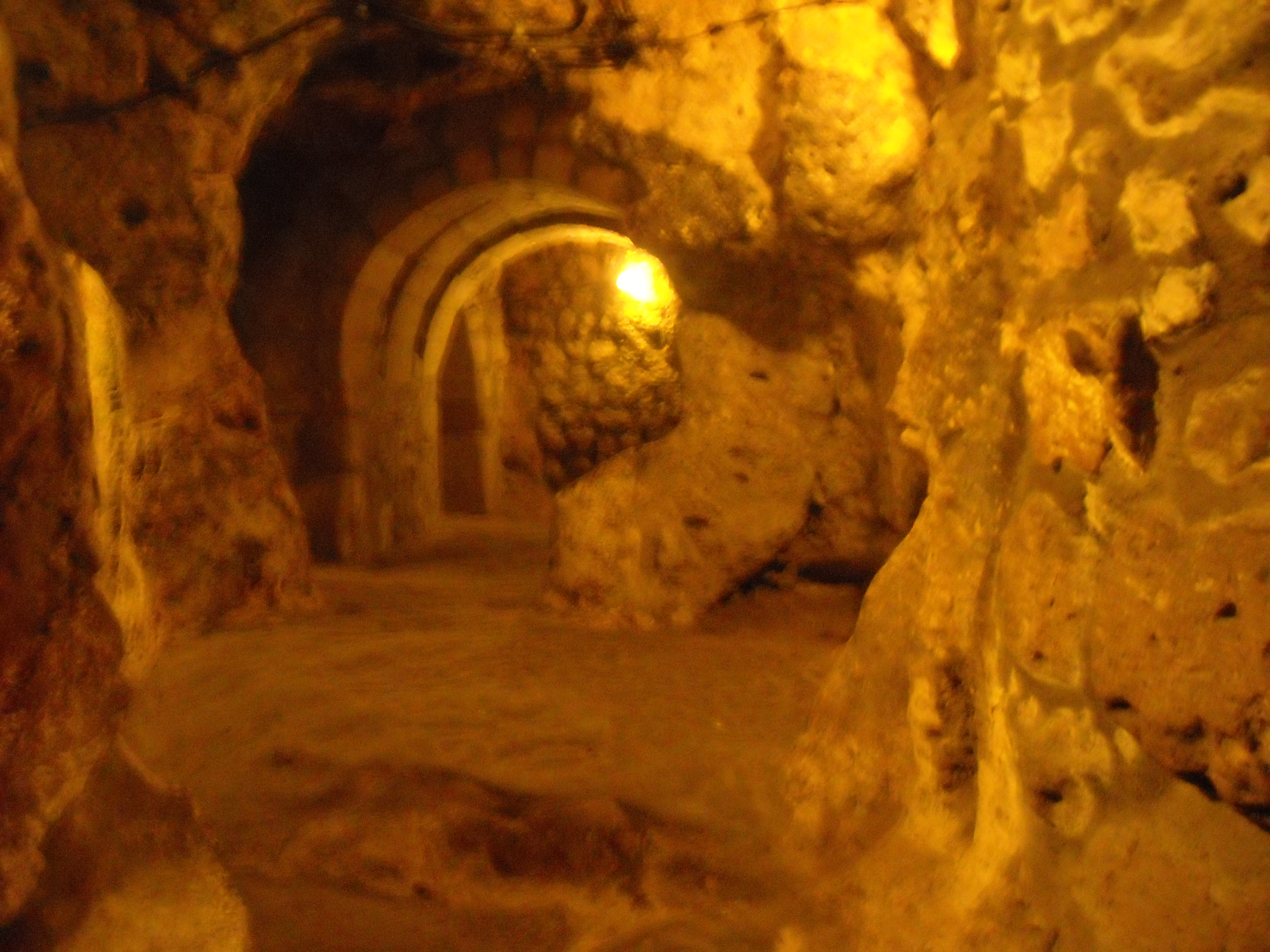
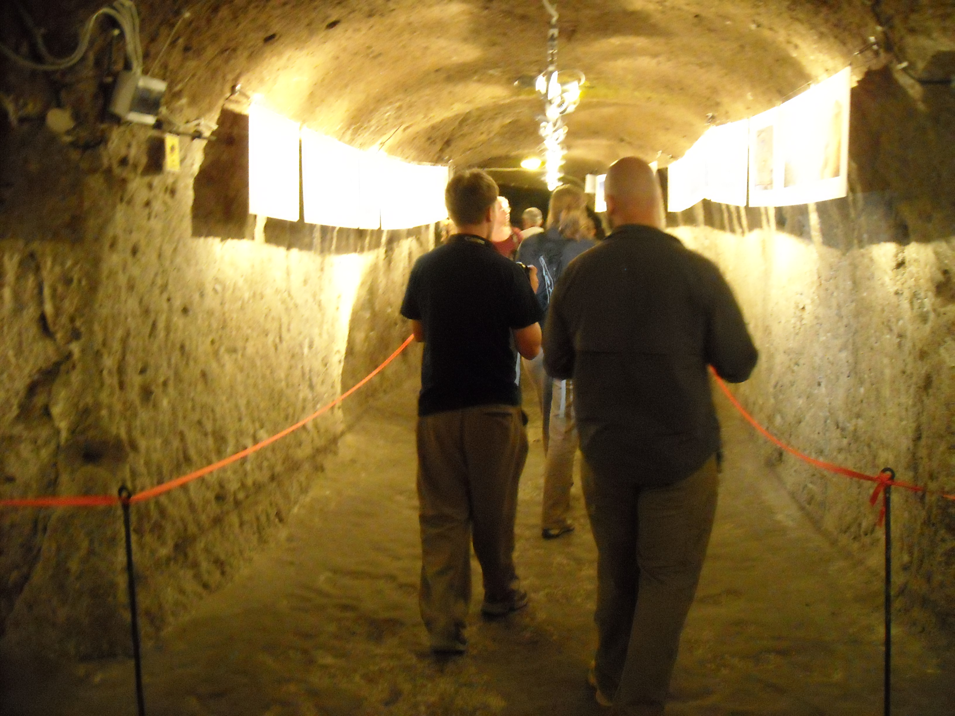
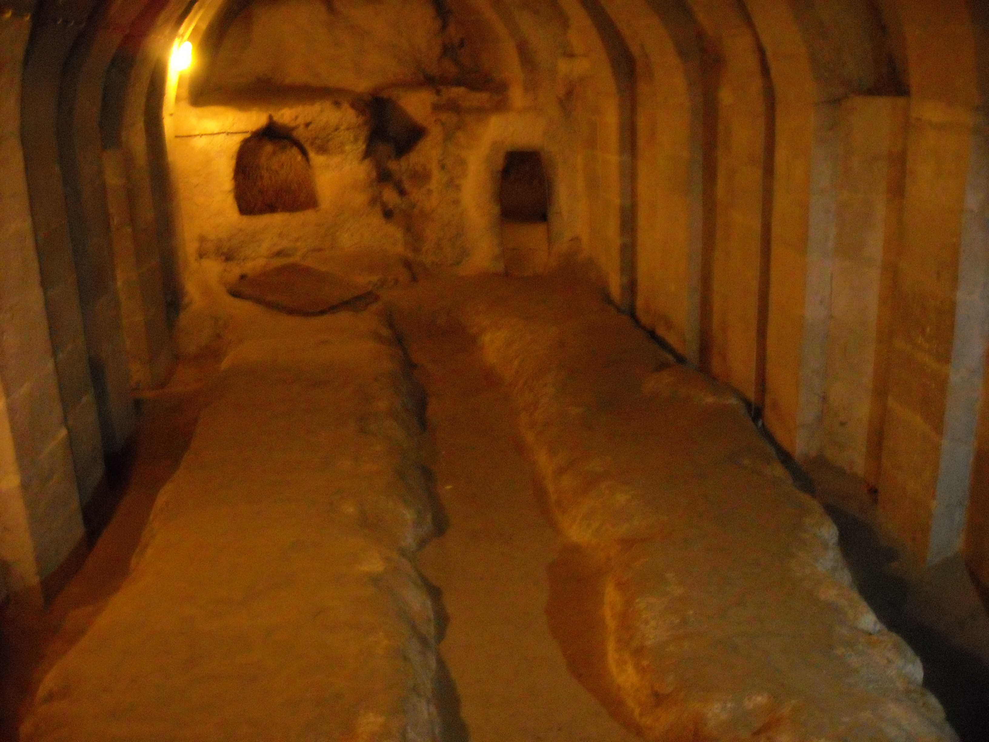
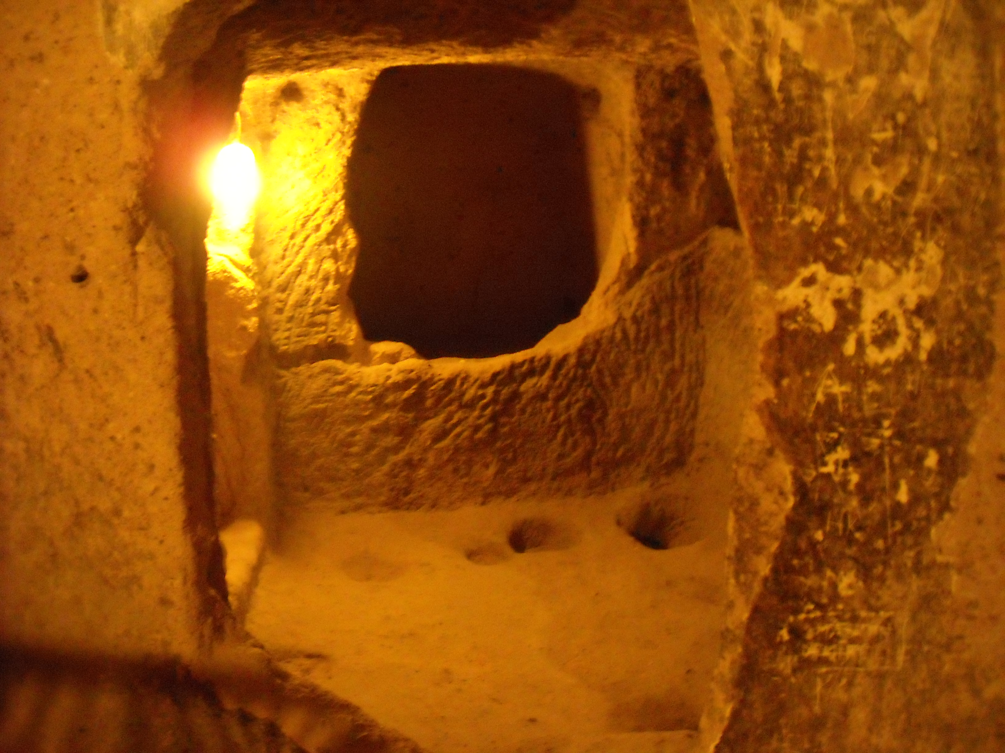
In a more traditional culture exploration this weekend, my family also took me to Cholula, a town 15 minutes away that is famous for the number of churches it has (not 365 as sometimes advertised, but around 70 or 80). Its most famous church, however, sits on top of the largest-based pyramid in the Americas that once was dedicated to the god, Quetzocoatl. My host dad and sister hiked up to the top with me, and the view was incredible!


xIMG_3300.JPGWe also got to see a ritual performance by the Voladores de Papantla. Essentially, a group of guys climbs up a tall pole with ropes in tow which are then wound around the top. Following a few minutes of preparation, the men swing down in circles, the ropes tied around their feet as they rotate around. It was terrifying but exciting to see.


xIMG_3324.JPGI’m not going to lie; I’m kind of bummed out that this is the last weekend I’ll get to spend in Puebla itself. From downtown and the neighborhood to places like Cholula or Africam that are right next door, I feel like I really could spend the entire 6 weeks just in this city and not get bored. I’m glad at how this weekend turned out, however, and it’s hard to not be excited about our trip to Mexico City this coming Wednesday!!!


Location: Cholula, Mexico

Hittite Happenings and Hidings…

Yazilikaya was the first stop on our tours today. After driving for about three hours, we arrived at the site, and piled out of the bus. When I had done research on Hattusas, Yazilikaya was always associated with the information. I thought this rock sanctuary was actually in the site of Hattusas, but I was wrong. It is near, on one of the rock outcrops near the site of Hattusas. Yazilikaya means “inscribed rock” and was once used as a temple and ritual area. The New Year and spring celebration festivals and rituals took place at Yazilikaya. This rock sanctuary depicts much of the Hittite pantheon of Gods. There are two main chambers which are open to the public, chamber A and chamber B. Chamber A was actually discovered in 1834 by Charles Texier, who thought these were Iron Age inscriptions (Texier believed the site of Hattusas was Pteria, so he thought he would tie this into his theory).

 Chamber A is very weathered because it was exposed for so long, so the inscriptions and reliefs are worn and hard to discern. Chamber B, however, was not exposed and was actually filled in, which preserved the inscriptions very well. I could tell the difference between the exposures when looking at the remaining reliefs. I was actually amazed at how clear the reliefs from chamber B were. I found it interesting how large this site was as a single ritualistic area when you compare it to some of the temples at Hattusas (not Temple 1, but the temples in the Upper City) and from Alacahoyuk. I also thought the proximity to Hattusas was interesting, because of the amount of temples at Hattusas. Yet, this site was important enough that they would perform the spring ritual here.

Hattusas was after Yazilikaya, and the site I am doing my presentation and paper on. This site was found in 1834, and excavations first started in 1906. Hattusas is the site that I have to research, present and write a paper on for the landscape Archaeology portion of this trip. I am also going to make a map of the site for my GIS course final.  There have been about 5 different people directing the excavations, so preservation techniques vary. It was pretty amazing to see how big this site really was. When you look at a map, or read about the different components of the site, you do not get a good idea of how large and far apart the different parts are. I do not think I will ever be able to imagine the site the same way as before visiting it. I did get to see the parts of the site I had been reading about, but we also we went to parts that I had not read about. I had thought I had looked up a lot of information, but it seems like there is always more to find. I just feel that I could have been more prepared, but I can not change the past. The only thing I can do is look up the information, so that I am informed in the future.  On of my favorite parts of visiting Hattusas was being able to walk through the only open part of the postern at Yerkapı. I also liked looking at the side of Yerkapı. It allowed me to see exactly how a 35 degree slope survives 2400 years.

Alacahoyuk was the last site of the day. It was presented to the public very nicely. There were signs for just about all the finds, and the site had flowers growing wild everywhere. The sight of the red poppies (at least I think they were poppies. I’m not exactly sure, because I do not know a lot about the varieties of flowers) and purple wildflowers are forever going to be incorporated with my memory of this site. I am also going to think about Turkish school children, whom seemed to swarm this site. As we were climbing through the postern, I could hear the children tramping down the stairs and running through the narrow tunnel. As I could only move as fast as the people in front of me, I was slightly afraid that some of the children were going to run into the back of me. Alacahoyuk is a Hittite (and pre-Hittite) site, with a temple, and a Sphinx Gate. It was interesting to see the reliefs and the gate with a similar style to Hattusas, but on a smaller scale, which seems to me like a much more likely spot for people to actually live.  

One might wonder why as a US citizen, the Hittite empire means anything to me. Well, this empire, which was smaller than the Mesopotamians and Egyptians was able to challenge and win battles against both. They were able to manipulate their landscape to help them gain power. At the same time, we can look at their collapse and other internal problems to determine what can be applied to todays governments. Through the study of the past, a better future can be possible.


Location: Selvi Hotel, Cadnkiri cad. No: 16, Ulus-Ankara, Turkey

Climbing through Cappadocia

The study tour around Cappadocia began with a trip to the Goreme Open Air Museum. Goreme was once a city which was carved into the Tufa stone that covers this area. There were actually people living in this town until the Turkish government had them move a little bit away from the site, so that the site would not be damaged anymore by daily living. DSCN3089.JPGThis is the area of Turkey where monasteries first came into use in the Christian world. The Christian priests believed that if one were to separate themselves from the daily life as experienced by others, then there would be less chance for them to sin. This was a measure taken to protect their innocence and untainted souls. Goreme was carved out around the Byzantine Period, and shows signs of the art from this period in the churches that are abundant at this site. DSCN3105.JPG We went into several churches, and we were able to see the difference between the frescos done by professionals and nonprofessionals. In most of the churches at this site, there was a Cappadocian cross. There was also the repeated image of the stylized version of Jesus on the cross with the two thieves beside him. This site did amaze me, however, due to the fact that all of these places were carved into the rock. There was thought about how the space was going to be used, and what had to be left so that more details could be put to use later. DSCN3090.JPGGoreme is also a UNESCO world heritage site. As we walked through this site, I felt like it would be difficult to live in this village. Everyone would have to live close together, and as you walked through an area, it wore down and became slicker, and harder to walk over. I could see myself falling from one of the buildings and doing some damage to myself.

DSCN3103.JPGAfter we went to Goreme, we went to the underground city, Derinkuya. This is a city that was formed by slowly scooping away at the Tufa stone which makes up most of this region. The city is well protected with mill stones, which would be used to close off passage ways, as well as having a good communication system within the city. Not only did the city have defenses, but the layout of these cities are not exactly easy to follow, and if you did not know where you were going, one could get very lost in the winding passageways. DSCN3124.JPG Derinkuyu was not just storage and housing, but it also had a church in the bottom level in the shape of an Assyrian Cross (slightly bent at the top, because they say that as Jesus died, his head leaned to one side). In the cross shaped church, a gallery was set up, which contained photos of the landscape in various parts of Turkey. DSCN3135.JPGAs we walked around in the site, there were times when it was less walk and more crawl and bend. The tunnels at the site can get pretty narrow, and the ceiling seems to get closer and closer to the ground as the tunnel continues. Sometimes I wonder how people were able to get through these passages on a daily basis.

DSCN3154.JPGThe second underground city, Kaymakli, was more interesting than the first city (or so I thought).  It was much easier to imagine people living in the second city. There were more rooms for living and storing. Also, the rooms seem to break off in random directions, which gave a more comb like feel instead of the straight through tunnels like the first. Because we were able explore the secondary rooms and tunnels, I felt like there was much to see. DSCN3157.JPGI loved climbing through the tunnels, even if we didn’t know where they went. I also felt like it would have been so easy to get lost in these rooms in the past. I wonder how people were able to climb through without the use of electric lights and flashlights. There were parts of the tunnel that were really small and narrow, which would make it very difficult to walk though holding a torch or something similar. I wonder if people would walk around in the dark, relying on the information they knew about where they lived. DSCN3160.JPG I don’t know if I would ever feel completely comfortable living at a place like this. I would have to bend down a lot to keep myself from hitting my head, and I would be a bit too wide for some of the tunnels we went through. DSCN3166.JPG


Location: Kilim Otel Dumlupinar Cad. No: 50, Urgup-Neveshir, Turkey

Wandering through Turkey

Today we traveled to Mount Nemrut (Nemrut Daği). So far this has been my favorite part of our trip. Mount Nemrut was an amazing site. However getting DSCN2865.JPGthere was a bit sketchy. The van driver did not drive on the windy mountain roads like I am used to. I felt sometimes that we were going to go over the edge. I was also at a window seat, so it didn’t help being able to see how close to the edge of the road we were. We didn’t die on the road, and were able to get up top of Mount Nemrut with out any injury. DSCN2870.JPG After scrambling out of the car, we walked up to the East Terrace. It doesn’t seem like much, but walking, even on the path at Mt. Nemrut was difficult for me due to the altitude. I grew up, and live in a valley my entire life. I also really do not like heights. I tend to avoid them as much as possible, so walking up to the East Terrace was kind of an accomplishment for me. I was able to force myself to walk on a narrow path on the largest mountain in the area. This is something that I can’t say I have ever done before. DSCN2894.JPG 

When I reached the terrace, I was pretty amazed. There was a large raised platform that I could sit on and look around at the surrounding landscape as well as out on the tumulus and the statues of the gods. I found it very interesting that Antiochus would have a statue of himself placed at the same level as the Gods. He was the ruler of this fairly small kingdom of Kommagene, yet he was able to create a cult around himself that people actually followed. The tumulus that he had constructed to be his burial place is 150 m high and has a 50 meter radius. His burial chamber was never found, and no one has the clearance to excavate the tumulus to continue to look for it. This site also had two of the longest Greek inscriptions in Asia Minor. The last thing that I found really interesting is that Teresa Goell, the first female that excavated in Turkey, was not mentioned in any of the Guide books that we looked at, and was not mentioned by the tour guide at all. When she was mentioned at the site, the tour guide had seemed like he had never heard of her. I am wondering if this is because they do not like to talk about female archaeologists’ accomplishments, or if it was because they simply did not like this woman. However, she did spend a large amount of time at this site, and even camped out in the summer and winter.

DSCN2921.JPGAfter Mount Nemrut, we continued to Arsameia. Arsameia was originally constructed in the third century BCE, by the Kommagene family Arsames. However, most of the artifacts and structures we saw today were made in the first century BCE. We walked along the path, which may have been the original path from the third century BCE, and we looked at two reliefs with carvings of deities on the front with inscriptions on the back. DSCN2926.JPGThen we were shown to a cave that ended with iron bars keeping people from entering. The second tunnel we were shown, however, was not blocked off. DSCN2933.JPGA small group of us (five including me) climbed down to the bottom of the cave tunnel to see if it opened up to anything, such as the burial chamber, it was supposed to be connected to. After climbing down for what seemed a long time, the group reached the bottom, which abruptly came to an end because the tunnel was filled in with rocks.  I enjoyed this part of the day very much. It is not everyday that you can climb down into a tunnel which once lead to a burial chamber of a king. The first bit of the tunnel was easy to get down into due to the carved stairs. However, as the tunnel continued, the stairs were replaced with a simple dirt tunnel which you had to use the walls to keep yourself from falling too fast down the tunnel. Climbing back up the tunnel was much easier and much quicker than going down. However, both ways I accidently kicked some loose rocks which hit one of the guys that went down ahead of me.

After Arsameia, we visited the Septimus Severus Bridge.  The Roman Bridge (Septimius Severus Bridge) we visited crossed over the Cendere (Cabinas) River, which is a tributary of the Kafta River (which is also a tributary of the Euphrates River). DSCN2944.JPGThis bridge was built in the second century CE by the XVI Legion. The bridge is 7 meters 50 centimeters wide, which was just enough space for 10 people to walk across together. There was no extra space given, so that the soldiers were not given any luxury. There were columns erected which had inscriptions on dedicating them and the bridge to the Emperor Sentimius Severus (who lived 193-211 CE) and his wife and two sons, Caraealla and Geta. When Geta was killed, his column was removed as commanded by Emperor Caraealla, which was the custom at the time. I found it amazing that the bridge was still standing, and that 10 people can actually stand abreast on it (there were ten of us, so we actually tried it).

Karakuş Tumulus was the last place we stopped on the way to the hotel. This tumulus was a memorial grave for the Kommagene Royal family of the first century BCE. We didn’t spend much time here, and there was not much that we talked about. However, it was interesting to compare this smaller tumulus to the one on top of Mt. Nemrut. It is much smaller in comparison, but it was created in the same time period.

DSCN2951.JPG 


Location: Euphrat Hotel Nemrut Dagi-Karadut Koyu 02446 Kahta-Adiyaman, Turkey