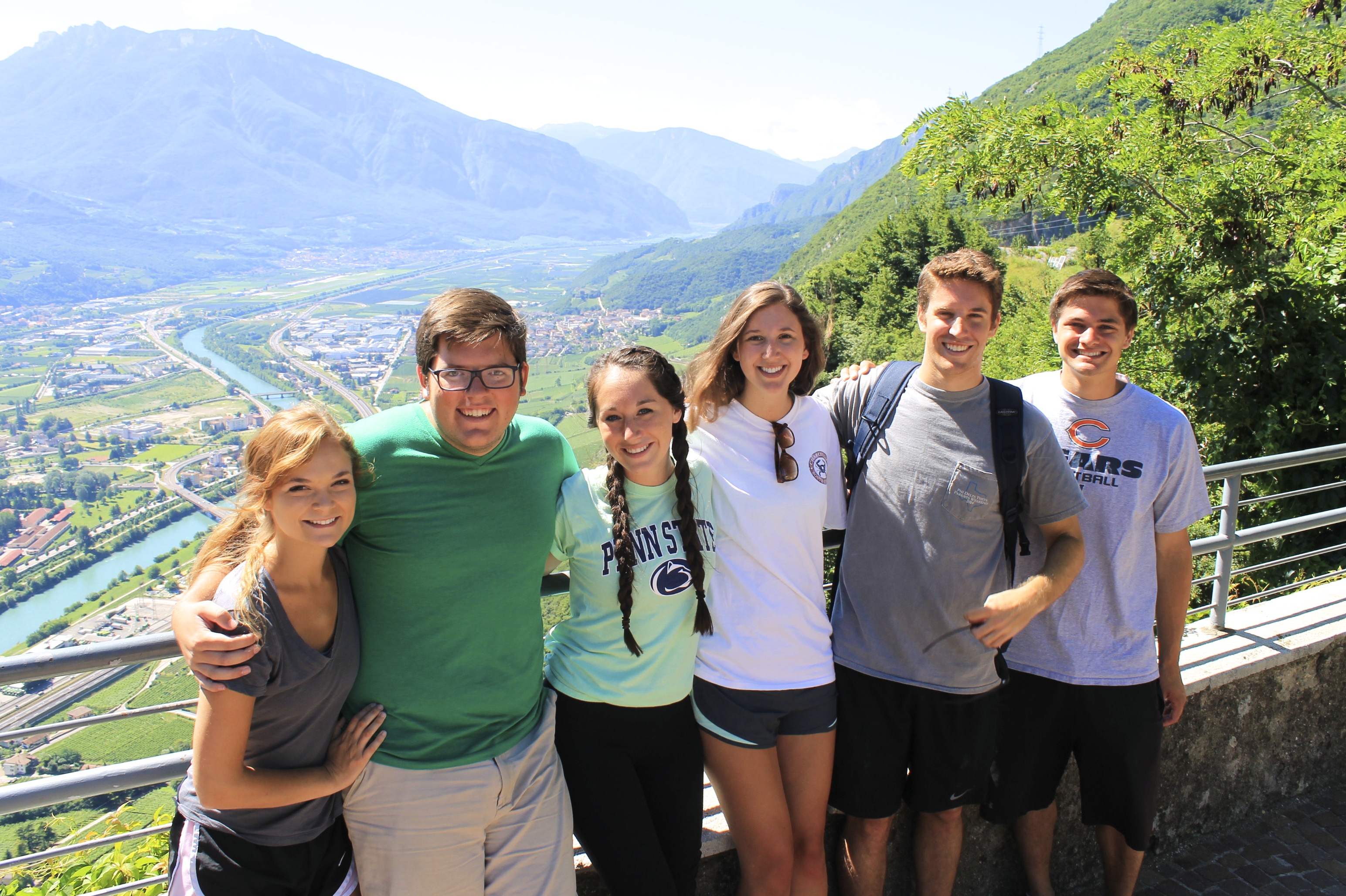
Today we visited the Hobbiton movie set just outside Matamata, used in the filming of The Hobbit and Lord of the Rings. Covering 12 acres, this beautiful landscape includes Hobbit Holes, the Mill, Lake, Shire, Green Dragon Inn and more.
Hobbiton Set Building
This property is owned by the Alexander family, and remains a fully functional working farm, producing sheep’s wool and cattle meat/hides. In 1998, Peter Jackson, director of the movies, approached the Alexander’s requesting to use the land for filming, and after the contracts were signed, he embarked on a journey of detailing sets, starting with site construction in 1999. To build the small town, the New Zealand Army was actually asked to assist in building roads, transporting equipment, and filling in a large swamp area to transform it into a field. Although they were not paid, they were reimbursed by being offered fighting roles in the movies. Most of these men were so enthusiastic about the filming that Jackson had to request them to tone it down so it was not too violent for a family movie, and three men were hospitalized for fighting a bit too intensely!
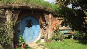
Hobbit hole
Details Details Details
The level of detail that Jackson included into his set is incredible, and can be seen on the property:
- Jackson did not think the sheep that came with the farm fit the time era they for shooting for, so he had the native sheep removed and imported sheep for filming.
- The wooden beams of the hobbit holes were distressed using a chainsaw, soaked in vinegar and dried to make them look the appropriate ago. A mixture of glue, wood chips, and cement was also used to splatter on wood, giving it the appearance that it is naturally covered in lichens.
- The orchard, which was originally comprised of plum trees in the book series, was not aesthetically appealing to Jackson, so he planted pear and apple trees instead. When it came time for filming, all the fruit and leaves were stripped off the trees, and artificial plums were attached to make the scene look comparable.
- There is even a tree on top of the hill that is completely artificial. It is made of a steel trunk and branch frame, painted with weatherproof material to make it look and stay looking realistic. Additionally, individual leaves were attached all over the tree, and later all individually painted a different color.
- There are also three hobbit holes built into the background hill of the valley, with the intention being solely just in case the camera accidentally paned and caught a glimpse of the background. All the work of altering the background landscape from its natural empty fields was shown for a grand total of three seconds throughout the film series.
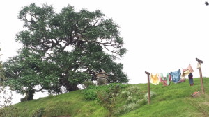
Fake tree mentioned above
On Set
Our tour began by bus, traveling though the filming grounds, where our guides pointed out different sections. The first main section was a large fenced-in field, which use to house over 250 species of animals used throughout filming. A section to the right was used to store tech equipment, and now is used as the farm’s maintenance department. There was a field used solely for all hair and makeup, next to a small hill that was acted as the communication hub of the property.
Following the winding road, you end up in Hobbiton, where majority of the filming took place. We walked through town, learning that all of the hobbit holes were only used for external filming, while all inside scenes for filmed in the “Hobbit Mansion,” an indoor set in Wellington containing over 130 separate rooms. On property, there are multiple sizes of hobbit holes, some on a 30% scale to make characters look large, up to a 90% scale to make other characters appear small.
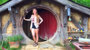
Stereotypical tourist photo at a hobbit hole
We walked though the pathways, garden, over the bridge of the lake, and into the Green Dragon Inn. This property serve four unique drinks, three alcoholic and one non-alcoholic, and can be found nowhere else in the world since they were created specifically for the movie set tours. The Green Dragon Inn is internationally and externally decorated and fully functional, even offering an area for private functions. The entire landscape of Hobbiton is extremely beautiful, encompassing the natural wonders of New Zealand, and enhancing them with movie set magic.
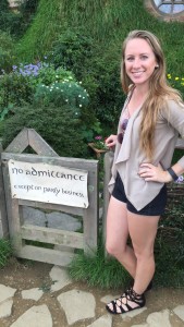
Iconic movie set sign
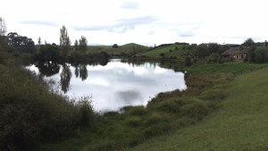
Lake and surrounding area
Woodlyn Park & Waitomo
After our tour of Hobbiton, we drove back to the Waitomo area, for our stay at Woodlyn Park. This theme hotel has a ship, plane, and hobbit hole themed rooms. We stayed in the “Waitanic” Ship Motel. Although it’s in the middle of nowhere and only a few rooms available, this iconic hotel has been recognized on TV and in media, and is well known for its unique appearance! We drove into the tiny town of Waitomo, a small village with not much more than a café, visitor’s center, hotel, restaurant, and bar. Waitomo is well known for its underground glowworm cave systems, where a lot of tourism happens, so the above ground areas are quite isolated. However, there are countless areas for nature-lovers and adventurers to explore. Essentially, Waitomo is more of an underground city!
Hobbiton themed rooms
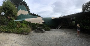
Plane themed rooms
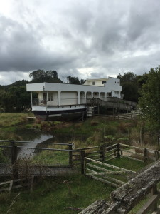
Ship themed rooms
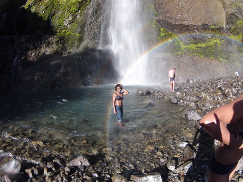
Following a late lunch, we drove to the Ruakuri Bush Reserve, known for being one of the top ten short bushwalks in New Zealand. Upon arrival we definitely could understand why, as we had a fantastic time exploring the natural wonders of caves, waterfalls, a river, and many outlook points. Although just a roughly 45 minute excursion including many photos, it was amazing how many things to explore were packed into this short walking loop.
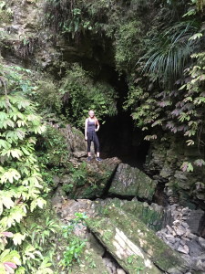
Standing in front of a cave that lead way back behind the greenery
Looking over a deep rock hole
Walking through a cave tunnel to a lookout point
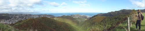
On the way back we pulled into a parking lot to read a sign, saw the words lookout trail, and decided to jog the short trail before the sun set. Through a short trail in the forest, up a bunch of steps, and a around a large field, we followed a skinny trail across the hill’s edge to a lookout with a 360 degree view around the local Waitomo area. From the lookout you could see the village as well as surrounding mountains and landscapes. It was definitely a great way to sight see Waitomo!
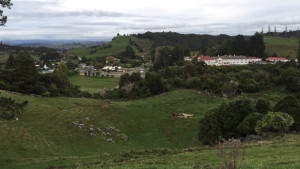
Town of Waitomo from lookout point